Klondike Hollow Project 007
20.66 Acres
Unpatented Lode Claim
Kerber Creek Mining District
Saguache County, Colorado
CO# 106332717
Price: 1,500 USD
Primary Metal
Gold/Silver
Secondary Metals
Lead & Zinc
Financing
Payment Plans Not Available On this Claim
Claim Features
Remote Location
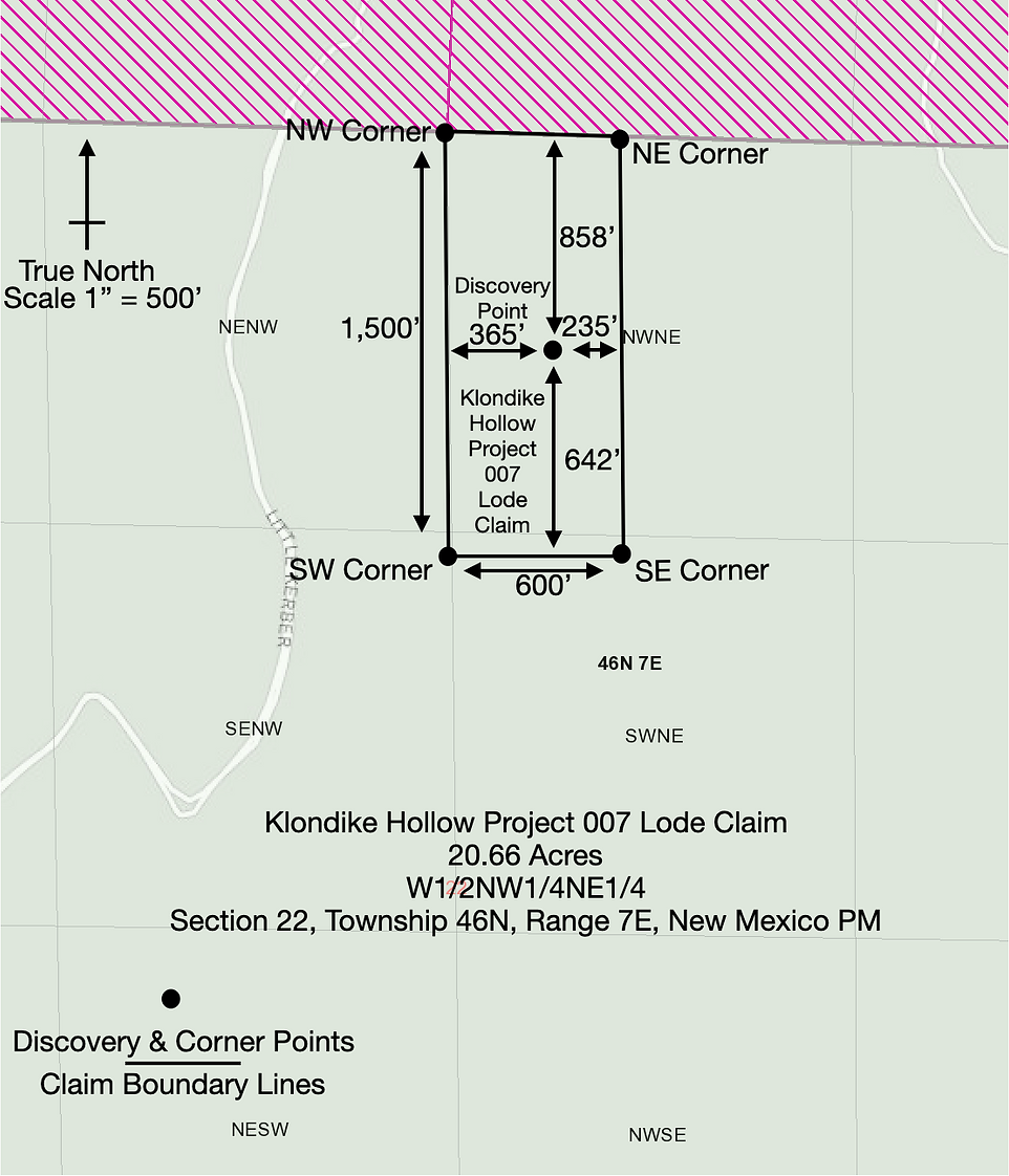
Precision Surveyed
Overview
Located outside the old abandoned ghost town of Spook City, the Klondike Hollow Project 007 Lode Claim sits directly on one of the known geologic vein structures in the area.
Featuring numerous dozer cuts, native rock outcrops, and small test pits. This claim is hike in hike out access only and is priced accordingly. The closest road access from the West is 552 feet with an uphill gradient. There is access along the ridge from the North with minimal elevation gain or loss, this path is 1,340 feet in length from the road.
Camping
Camping is allowed in established dispersed campsites for up to 14 days continuous. There is 2 bars of cell service on the claim and even better cell service across the main topographical saddle to the West of the claim.
Access
10.5 miles from the town of Saguache.
With no thru access the claim has minimal traffic and has largely been sheltered for years by the high elevation, short mining season, and lack of continuous loop road infrastructure.
History
The Ford Creek/Bonita Hill area was primarily developed for its lode gold and silver sources. The lode mines are extensive with numerous adits, shafts, and trenches dug and developed North and South of this lode claim.
Geology
Local alteration of early barren stage of alteration by fumarolic or acid hot spring activity resulted in intense silification, wall rock replacement by jasper and alteration products of hematite, diaspore, alunite, barite, zunyite, rutile, and kaolin minerals.
Later mineralization stage by alkaline or neutral solutions deposited ore and gangue and caused micaceous alteration (sericite and chlorite) and calcite, quartz, and pyrite.
Associated Rocks
Rock Types
Volcanic Rock (Aphanitic) > Intermediate Volcanic Rock > Andesite
Rock Unit Name
Rawley Andesite
Stratigraphic Age
Oligocene
Host Rock
Rock Type
Volcanic Rock (Aphanitic) > Intermediate Volcanic Rock > Andesite
Rock Unit Name
Rawley Andesite
Geologic Structures
Regional
Sawatch Range, San Juan Volcanic Field, Rio Grande Rift
Local
Bonanza Caldera
Drone Photo Of Main Workings
Claim Map
Satellite Claim Boundary Overlay
Recommended Mining Methods
Hard Rock Mining / Rockhounding
What Is Included In The Purchase
-
Quit Claim Deed
-
Google Earth Map
-
Waterproof 24X36 hardcopy 1:24,000 Map
-
Corner & Discovery Point GPS Coordinates
-
2 Hours of Free Complimentary Consulting
-
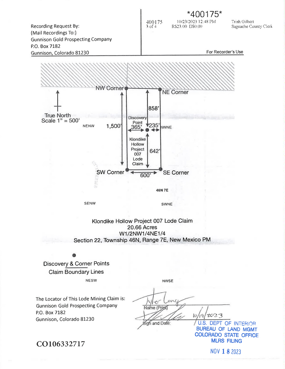
Certificate of Location Copy
Prospecting Disclaimer
The Klondike Hollow Project 007 Unpatented Lode Claim CO# 106332717 is an Unpatented Federal Mining Claim. Any form of mining or prospecting is barred without prior approval from Gunnison Gold Prospecting Company. This website listing does not constitute or convey approval from Gunnison Gold Prospecting Company to mine or prospect the claim in any capacity. Mineral theft is a Federal offense and is prosecuted to the fullest extent of the law as listed in the 1872 Federal Mining Laws.
Next Steps
-
Contact Me
-
Setup A Prospecting Day if you would like to test the claim before purchase (Optional)
-
Buy Outright or Finance In House
Contact Information
Tyler Long
Lead Prospector
Gunnison Gold Prospecting Company
Direct Line: 970-901-9043
tyler@gunnisongoldprospecting.com